The highest point in Kerala is Chembra peak, in Wayanad. It stands 2100 meters and is higher than both Kalsubai in Maharashtra (1640 meters), and Mullayangiri in Karnataka (1950 meters). Here's an account of our trip to Chembra. I got a guest writer this time ... Ujjwala Menon, who was good enough to pen her experience down for me.
Thanks Ujjwala ...
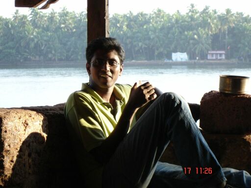
Wayanad : A trip to God’s Own countryDay 0: September 22, 2006Time: 10:30 p.m.Venue: Reception, The Senate, HCL Bangalore.Well the moment of truth came and we all assembled there except for a few latecomers (Mr Manoop!!!) Our group comprised of a fair mix of South Indians with our trek leader (read Ajay) also being a mallu so the trip was smooth with no need for exercising our sign language capabilities.
The bus ride was fun but the luggage was overflowing due to the over planning of the enthusiastic first timers but it’s a known fact that we Indians adjust everywhere. So with rounds of intro and singing songs (all types!!!) we proceeded to Wayanad ...
Day 1: September 23, 2006Time: 7:00 a.m.Venue: PPS Holiday Home (Kalpetta)
All of us alighted half-slept yet full of excitement, and dumped our luggage in the rooms (which was a luxury according to the seniors) as the plans for camping had been cancelled due to reports of heavy rain, but thankfully the weather was just right. We had breakfast and proceeded towards Meppadi, the base of the Chembra peak where we got our lunch packed ...
Then through the winding roads and the amazing scenery around we proceeded towards the point where we had to start the trek (I don’t know the name) and so mission Chembra started.

After a fun trek, we all managed to reach a height of 1650 meters above sea level. Our dear Manish had some teething troubles but he eventually made it under the able guidance of some of the co trekkers. The sights surrounding us were just amazing with the clouds coming on our faces. It was breathtakingly beautiful and the highlight of the trip was the heart shaped lake. It was very serene and these kind of sights make taking all the pains worthwhile.

We had our lunch there while the more enthusiastic chaps decided to get to the peak. It took them an hour to get to the peak (1835 meters) and back, by which time the rest of us had started the journey back. The path had become a little slippery after the slight drizzle and there was every possibility of finding leeches, but thankfully I encountered none. Later we had a grand dinner at the guest house with everybody hogging and the poor waiters running around all over the place to take our orders!!!
Day 2: September 24, 2006Destination: Meenmutty Waterfalls.Excited and stunned by the awesome trek of day 1 to the Chembra peak, all of us again braced ourselves for what seemed to be a light outing to see Meenmutty waterfalls.
We reached Vaduvanchal from where the vehicles could not go any further. The falls were a 1 km walk from here through coffee, cardamom and arecanut plantations, and we clicked a lot of photographs enjoying the pristine beauty of Kerala.

It had been raining the night before hence the path was a little slippery, and a local guide came in to take us till the falls. As we kept on walking the path started becoming narrower and winding but there was no sign of the falls!!! There was a deep valley on one side and we were walking on the other side. Then slowly the mud and grass gave way to rocks which were also slippery because of the rain. I was down on all fours and with ample help from my co-trekkers was able to climb down that stretch, there were times where the rocks were in an odd formation and you had to jump, or maybe slouch but it was very adventurous and slowly the sweet sound of water gushing was becoming louder. And then lo and behold there was an opening, and then we saw the virgin Meenmutty falls and the water gushing forth in abandoned joy.
The falls come down in 3 stages totalling a height of 300 meters. For the point we were at, we could only see the middle stage. More trekking needed to see the other stages of the falls, so we just decided to give it a pass :-)
We could not go near the water because the rocks were too slippery, we just stood there near the falls stunned by the beauty and everybody was overawed by the sight in front of us. We got wet simply by the shower sprayed when the water hits the rocks!!!
While going back it had started raining and the climb up the rocks was a little arduous. We reached our vehicle and then we all proceeded for an authentic lunch at a local restaurant in Vaduvanchal.

After lunch we proceeded to Kaduvakuzhi caves. The caves were discovered very recently and were named thus because of the leopard that inhabited the caves (Kaduva = Leopard, Kuzhi = hole in the ground). These are actually enormous underground caverns and the people we spoke to claimed that there were huge water bodies inside with fishes et al, but unfortunately we did not have the proper equipment and also we could not locate the cave mouths properly. Somewhere below us was the cavern we could not get to ... but the disappointment did not stop us from admiring the scenery and taking some very nice pictures. Finally, we left for Bangalore fulfilled after the awesome time we had.
Eagerly awaiting the next trip ...